

I found a large number of old maps in a History Department storage closet today. (I was happy to discover that the History Department has kept their old stuff in very nice order.) These are the kind of maps that are kept folded inside heavy covers so they look like bound manuscripts when you see them sitting on a shelf. There are a lot of them–just eyeballing it I’d say about a hundred. It makes me wonder if some endowment for the purchase of maps once existed. Here’s one unfolded back in the Woodson with several others sitting on top. Note the perfect white lines where the folds are.

Faculty members used them in the classroom, usually hung on a hook attached to the top rail of the chalkboard. As soon as I realized what I was looking at I remembered this photo of Rice History Professor Floyd Lear standing in front of one:
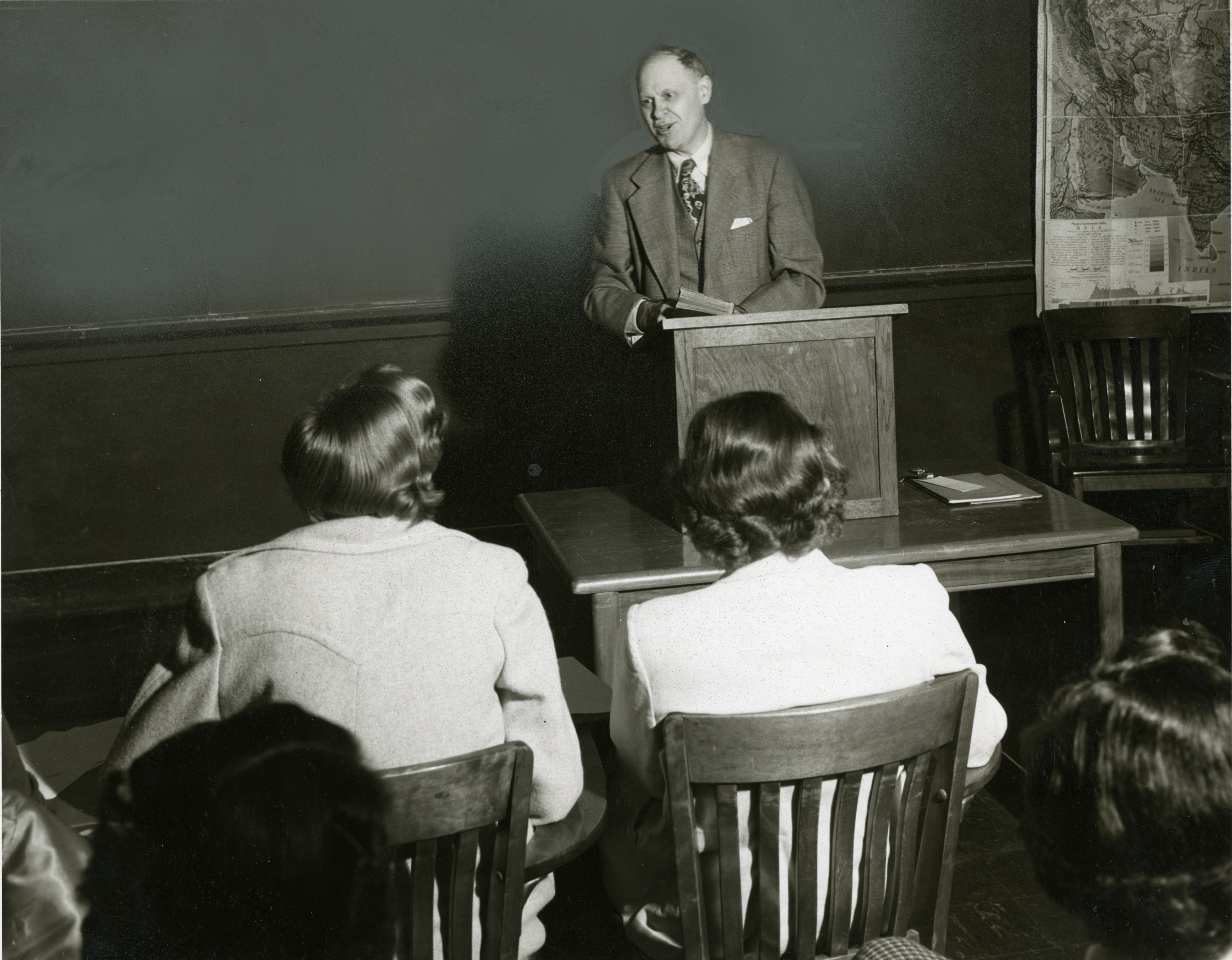
If you zoom in on this you can see that the folds on the map are very similar to the ones above. (If I can go a bit off topic for a moment (and really, who’s going to stop me?), as I look at this photo again I recall that one of the other things I saw in that storage room was a small wooden podium like the one he’s lecturing from. I wonder if it’s the same one. I’ll check.)
In all honesty, I don’t really think these maps are obsolete. The worst you could fairly say about them is that they’re kind of clunky, but it seems to me that they are actually superior in some ways to the powerpoint slides that have replaced them. For one thing, many of them are simply beautiful.
Bonus: